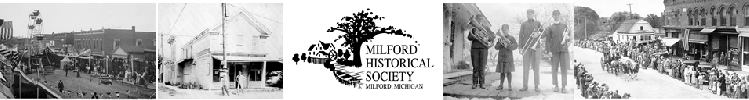
North Milford Village Historic District
Oakland County, Michigan
Description
The North Milford Village Historic District consists of approximately 140 acres and
includes the historic commercial area along three blocks of North Main Street, residential
areas along five east-
The agriculture and mill settlement of Milford developed on the western edge of Oakland
County during the nineteenth and twentieth centuries. The historic core of the village
is located on both sides of a bend of the Huron River at the point where Pettibone
Creek flows into the Huron. The Huron River originates in a series of lakes in Commerce
Township, east of Milford Township, runs, at its entrance into the township, in a
northwesterly direction, thence at the village westerly, and thence south and southwesterly
through Kent Lake, and eventually through Ann Arbor, Ypsilanti and into Lake Erie.
Pettibone Creek originates in a series of lakes north of Milford in Highland Township
and enters the Huron River approximately in the center of Milford Village. Both
the Huron River and Pettibone Creek furnished water power to the early settlers,
with three water powers on the Huron and five on Pettibone Creek. The Village is
situated in a valley surrounded by hills covered with oak in early days. The land
surrounding the Village was primarily farmland, but has now been developed into large
residential lots and subdivisions, with one-
The primary approaches to the Village of Milford are South Milford Road running north
from the I-
Street. Early routes through the Village were Old Plank Road, a stagecoach road running northwest from Grand River Road in Lyon Township, south of Milford Township, and Commerce Road, then a stagecoach road from Pontiac to Howell,
Michigan. The earliest street in Milford Village connected the first two mills and was then called Main Street, now called Huron Street. Present Main Street was then called Grand River Street.
The village has been laid out in a plan of generally narrow north-
The commercial buildings are found along North Main Street, E. Commerce Street, E.
Liberty Street and Canal Street and are representative of Milford's second era of
prosperity sparked by the arrival of the railroad in 1872, and the third period from
World War I to 1950. The buildings are primarily two-
The historical residential area in this part of the Village is found on the northern
part of North Main Street, on five north-
end of First Street (Atlantic Street). Along these principal streets, Milford's merchants, mill owners and retired farmers erected primarily wood frame houses in styles that were popular during the nineteenth and early twentieth centuries. Many of the late nineteenth century houses exhibit detailed woodwork and expert workmanship. Interspersed in the residential district are a few carriage houses and barns. Mature shade trees line a number of these streets, but many have been lost to disease in recent years and have been replaced with young trees.
On North Main Street, moving north from the commercial district, are several wood frame houses designed in the Gothic Revival, Italianate and Dutch Colonial Revival styles, and one Greek Revival house moved to its site from Union Street when the parking lot behind the stores on the east side of North Main Street was built in the 1950's. The district ends just above Summit Street.
North Milford Road branches off from North Main Street at an angle just south of
Detroit Street. Three of the early mill sites are along this street as well as the
Upper Mill Pond on Pettibone Creek, which was the water-
Running east from North Milford Road and Summit Street along Summit, are a commercial building, a Gothic Revival house and the Hibbard Tavern, a former stop on the stagecoach road which ran through Milford on Summit Street. The district ends at Union Street.
Running east and west along Commerce Street from the commercial district on North Main Street are wood frame, concrete block and brick houses constructed in the 19th and 20th centuries, including Greek Revival, Italianate, Victorian Gothic, Vernacular, Dutch Colonial, American Foursquare, English Cottage and Cape Cod styles. On this street also is the early twentieth century stone church built by the Catholic congregation of St. Mary, Our Lady of the Snows, as well as its stone rectory. The houses were originally owned by many of Milford's merchants. The district ends before Crystal Street on the east and at Cabinet Street on the west.
Running east four blocks along East Liberty Street from the commercial district on
North Main Street are several of Milford's outstanding historical houses. Liberty
Street was apparently the earliest route from South Milford to North Milfordafter
crossing the Huron River. All but one of the early Greek Revival houses, a blacksmith
shop and a wagon shop were moved or torn down in the late nineteenth century to make
way for the homes of Milford's prominent merchants and professional people. The street
is lined with wood frame and concrete block Greek Revival, Italianate, Victorian
Gothic, Queen Anne, Chateauesque, Dutch Colonial Revival and Craftsman/Bungalow
style houses constructed from mid-
Union Street, paralleling North Main Street to the east, and running north from Canal Street to just north of Summit Street, was a residential street in historic times. A number of the historic houses in the first three blocks are now professional offices. The first and second Methodist Church buildings were on the southern end of Union Street. The second building remains, but is now the Masonic Temple. Continuing north on Union are wood frame and brick Greek Revival, Vernacular, Late Victorian, Second Empire, Stick, and Bungalow style houses built from the early nineteenth century to the early twentieth century.
Hickory Street, paralleling Union Street to the east, and running north from Canal Street to Summit Street, is a residential street of wood frame, brick and concrete block Greek Revival, Italianate, Late Victorian, Queen Anne and Bungalow style houses dating from the early nineteenth century to the early twentieth
century.
East Street, paralleling Hickory Street to the east and running north from Canal Street to just north of Commerce Street, is a residential street of wood frame and brick Greek Revival, Victorian Gothic, Late Victorian, Queen Anne, Bungalow and Tudor Revival houses dating from the early nineteenth century to the early twentieth century.
First Street, paralleling East Street to the east and running north from Atlantic Street to East Commerce Street, is a residential street of wood frame, brick and shingle Greek Revival, Italianate, Victorian Gothic, Late Victorian and Bungalow style houses dating from the early nineteenth century to the early twentieth century. The district ends just north of East Commerce Street on the north, at the rear of the lots on the east side of First Street on the east and angles south and west across the Huron River to include two mill sites.
The historic section of East Canal Street runs east from First Street one block and ends at Houghton Street on the east. It is a street of six wood frame Victorian Gothic and Queen Anne houses, one Bungalow and one carriage house built in the late nineteenth and early twentieth centuries.
Running east along Atlantic Street from the south end of First Street to Crystal Street on its south side and to Bennett Street on its north side is an area of wood frame Victorian Gothic houses, twelve of which were built from the late 1860's to the end of the 19th Century and two very early houses, one from ca. 1839 and one, the home of Milford's founder, Elizur Ruggles, from 1843. Sixteen houses: Bungalows, Tudor Revivals, Vernaculars and Cape Cods, built between 1900 and 1950 , complete the area.
Running south from Summit Street at the north to just below West Liberty Street on the south and west from North Main Street to the district boundary at Cabinet Street is an area which encompasses the Upper and Lower Mill Ponds and the sites of two early mills, now gone but marked with a metal historical marker, and the existing Henry Ford "little mill in a meadow" on the west side of the Upper Mill Pond. This area also includes one wood frame Vernacular Victorian and one brick Victorian Gothic house on Oak Street, part of the 1872 railroad which runs through North Milford, the 1888 stone railroad archway over the Huron River and the Henry Ford power house at the foot of the Lower Mill Pond.
The overall architectural integrity is high. Alterations consist of remodeled store front entries and removal of some cornices in the commercial district and additions, enclosed porches, window replacement, removal of wood trim, as well as the overlay of aluminum and vinyl siding in the residential district.